Chesil Beach and the Fleet Lagoon
18 miles and 180 billion pebbles
Ferrybridge - Transport

The Ferrybridge area carries the main transport links between Weymouth and Portland. The major hurdle for the transport links was the channel linking Portland Harbour to the Fleet. The channel is 3-4 metres deep and with strong tidal currents.
Before the nineteenth century passengers from Portland would travel to the end of a sandspit close to Wyke Regis by foot or on horseback. A ferry boat would transport them across the channel in a small boat that was either rowed or rope-operated.
For a few days each tidal cycle it was possible for horses and carts to ford the channel on a low spring tide. A shallower sand bar existed across the channel just as the channel entered the deep water of Portland Harbour.
Larger goods items would have been taken by ship between Weymouth Harbour and Castletown pier on Portland.
The ferry and the fordable track was destroyed in the great storm of 1824.
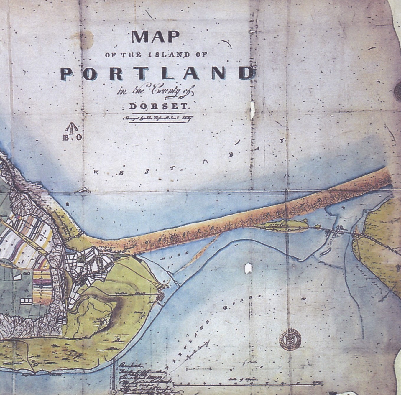
The map on the right shows an excerpt from Taperell’s map, dated 1837. This was 10 years after the great storm of 1824 which swept away the old ferry arrangement and the fordable area,. The mouth of the Fleet is considerably wider than it is today.
Following the damage to the area in the 1824 storm pressure grew to build a road bridge. This opened in 1837 and is now in its third incarnation.