Chesil Beach and the Fleet Lagoon
18 miles and 180 billion pebbles
Ferrybridge - Road

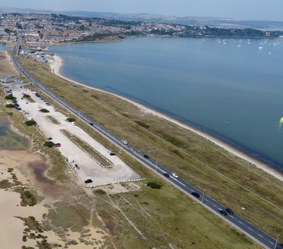
The A354 Weymouth to Portland road runs from the southernmost part of Wyke Regis to the southern part of the Ferrybridge area, It is a single carriageway road with a roundabout at each end of the stretch through the Ferrybridge area. At the northern end the speed limit is 30 mph changing to 50 mph for the rest of its run through the area.
The route follows the same route as the early cartway that ran to the ferry across to Wyke Regis. The northern section runs on a man-made embankment faced with Portland stone blocks

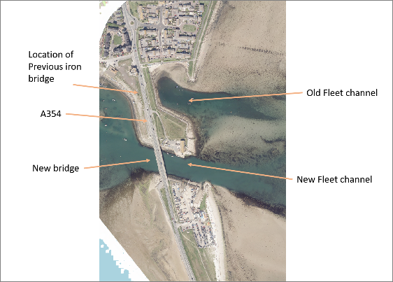
This embankment was initially constructed for use with the first bridge across the Fleet in 1839. In order to reduce maintenance costs the bridge span was reduced in 1867 and the embankment extended accordingly. This bridge was itself replaced with a metal bridge in 1896.
In 1983 the iron bridge was deemed unsafe and work started on a replacement which opened in 1985. This new bridge was located south of the iron bridge to allow construction to proceed without interrupting the flow of traffic. It meant the northernmost part of the road embankment was removed and a new section on the north side of the bridge built.
The road has suffered from flooding during storms when waves come over/through Chesil Beach. In October 1976 the beach was breached during a storm at the southern end of the area and the road severely damaged. The southernmost section was raised in level during the 1990’s to reduce the impact of flooding.
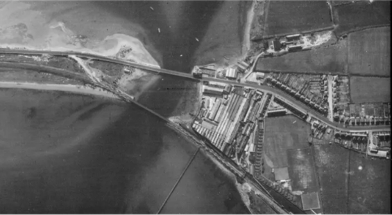
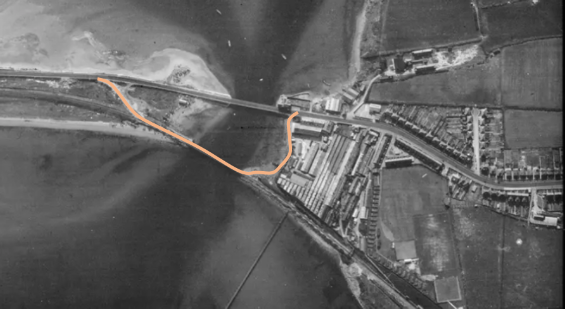
During the WWII there was a danger that the road bridge would be bombed, cutting off access to Portland and its naval base. To counter this the railway bridge was altered to allow road traffic to drive over it with access roads at each end as shown below.
View of the road/railway bridges in 1946. Hover cursor over image to see the course of the diversionary road.