Chesil Beach and the Fleet Lagoon
18 miles and 180 billion pebbles
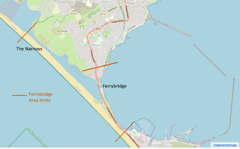
Ferrybridge - Description

The Ferrybridge area is where The Fleet joins Portland Harbour. It has suffered the greatest impact from man’s activities. This is due to a number of reasons, including its importance as an area carrying the transport links to Portland, but also because of ease of access, deeper water than the rest of The Fleet and closeness to Portland Harbour.
The area described in these pages is defined in the map above and stretches from the Narrows in the north down to the Chiswell drainage channel and includes the southernmost area of Wyke Regis.
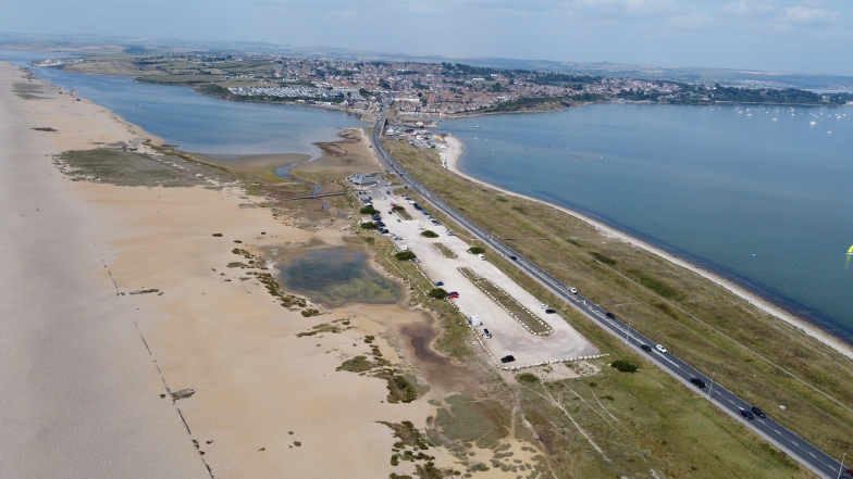
In this area Chesil Beach is at its highest and widest and provides a substantial barrier protecting the area from south-westerly storms. The Fleet is typical around 3-4 metres deep in the main channel with substantial sandbanks and flats on both sides. Hamm Beach forms the eastern side of the area and is a sandy beach with some pebble areas. The southern part of Wyke Regis sits on a bank of clay and the shoreline suffers from significant erosion. The peninsula carrying the road and old railway is a sandbank which has been significantly changed by man.
The area covered by the Ferrybrige web pages