
|
B3157 |
The road that runs parallel to Chesil Beach from Weymouth to Bridport. Be aware this is a narrow, twisty road in places and has major weight and width restrictions. |
|
Bass |
The European bass Dicentrarchus labrax is common in the Fleet. The Fleet lagoon is a designated nursery area for the species. Fishing for bass with nets is not permitted anywhere in the Fleet. Angling for bass is only permitted in the Lower Fleet from the Narrows to Ferrybridge and only from the shore. However, all fishing for bass in the Fleet is discouraged by the Southern- |
|
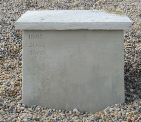
Beating the bounds |
A ceremony carried out every seven years at the Portland boundary stone which involves ceremonially beating a boy and a girl pupil from the Atlantic Academy School on Portland with a reeve staff. The aim is to teach children the location of the ancient boundary between Portland and West Dorset. At each ceremony there is a short religious service, the beating is carried out, the location of the boundary stone is checked and the date is carved on the boundary stone. A description of the 2016 ceremony can be found here and the 2023 ceremony here. |
|
Boating |
No boats are permitted in the Upper Fleet beyond the Langton Herring parish boundary. Canoes and rowing boats are permitted in the Mid- |
|
Bombing decoy |
During World War 2 a number of bombng decoys were built around the UK to simulate real targets. As part of the 'N' series of decoys for naval ports a number of decoys were built in the Chickerell Hive and Tidmoor Point area. These included QF, QL and Starfish type decoys. |
|
Bombing Range |
The Fleet was used as an experimental bombing range by the RAF before and during World War II. The bombs used during the Dambusters raid were tested on the Fleet range. Support for the range was provided by the nearby airfield at Chickerell. The huts and slipway at Chickerell Hive Point are believed to have been constructed to support the range. Large concrete marks were constructed along the beach to guide aircraft onto the range. Whilst mostly obscured now by storms moving pebbles over them some remnants are still visible. |
|
Boundary Stone |
A carved stone on the top of the beach marking the boundary between Portland and Chickerell and also the boundary between Crown Estate land and Ilchester Estates land. |
|
Brick pit SY644798 |
A disused brickworks and clay pit south of Chickerell which is now partially a council depot and the rest a nature reserve with a large pond. Access is by obtaining a key from the council depot office. The pit was formed by digging away the north side of Crook Hill. The reserve is an SAC and SSSI designated sites for the great crested newts in the pond. The reserve is also noted for its geology and fossils and is a GCR site. See the Natural England website for more details |
|
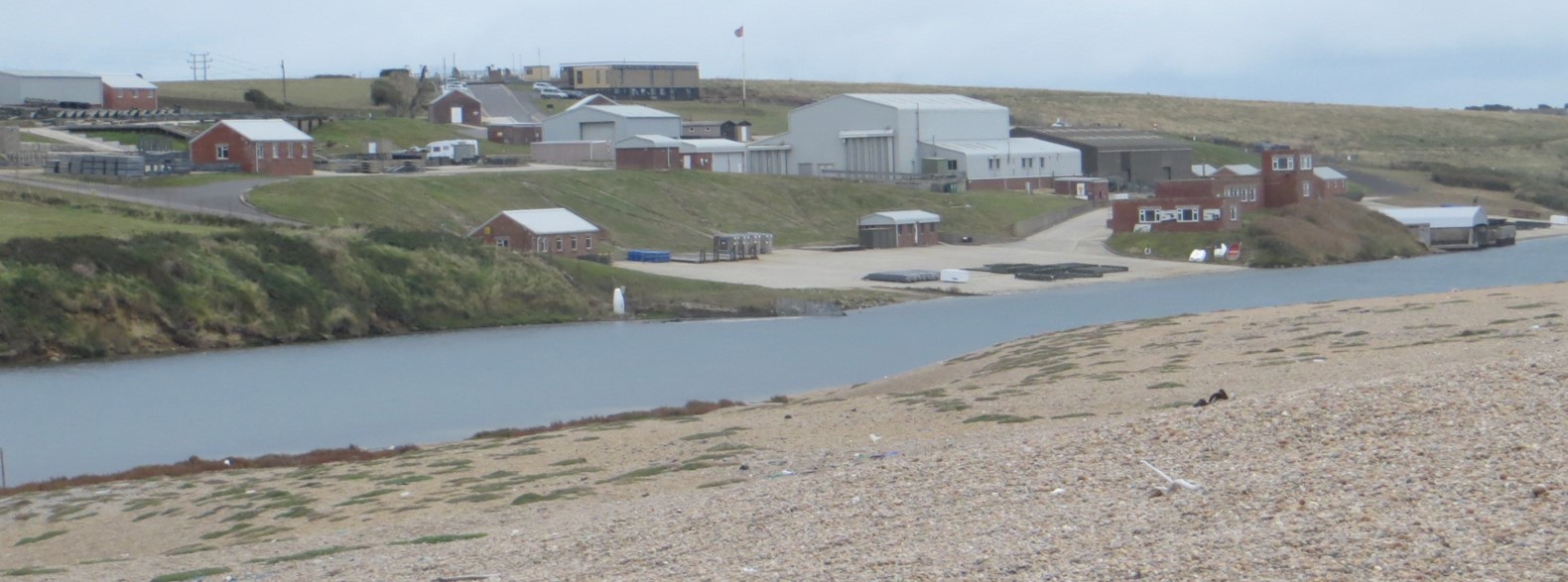
Bridging Camp SY651774 |
The Bridging Camp is a an area used by the Royal Engineers to train soldiers how to build bridges and ferries across fast flowing water. Originally established in 1928 it has expanded over the years and adapted as the technology of temporary bridges has changed. More information is available here. |
|
Bum Point SY572839 |
Located in the upper Fleet within Abbotsbury Swannery. The name may be a corruption of Baum Point, meaning a tree- |
|
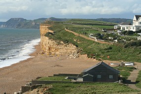
Burton Bradstock SY483891 |
A village near the north- |
|
Burton Hive SY483891 |
Part of Chesil Beach near Burton Bradstock. There is a National Trust car park near the beach. |
|
Burton Mere |
An area of water trapped behind Chesil Beach south of Burton Bradstock |
|
Burton Road |
The old road running along the back of Chesil Beach between Abbotsbury and West Bexington. Note that this is now a footpath only. |
|
Butterstreet Cove |
A bay north of Chickerell Hive Point. Much used by wading birds and wildfowl. Access is by foot only past Fleet old church or via the South- |