 |
Postcards from Chesil
About this site
 |
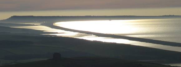
These pages present a series of old postcards from around Chesil Beach. These have mostly been obtained from local Dorset markets, particularly Bridport market. All images are presented here at a resolution of 350 by ~200 pixels. Clicking on an image will download a higher resolution image at typically 800 X 600 pixels. The full resolution images are also available, where copyright laws allow, contact ed@chesilbeach.org. Note that copyright of all pictures remains with the original owners. Where appropriate, permission must be sought before using the pictures for any purpose.
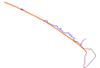
The outline map in the top right-hand corner is a guide to the location of the pictures.
The cards from Portland portray the development of North Portland and the southern end of Chesil Beach over the last 100 years. Of particular interest is the second tombolo linking Portland to the mainland which is now buried beneath the Heliport.
The cards from West Bay and Burton Bradstock portray the major changes to the northern end of Chesil Beach over the last 100 years. There has been significant cliff erosion at Burton Cliff and the pebble redistribution at West Bay is very obvious.
We are always on the lookout for additional pictures to add to this site. If you have any old postcards or photographs not already included then please contact ed@chesilbeach.org. We are particularly looking for pictures of the beach at Abbotsbury and West Bexington and from the beach and Fleet shoreline between Abbotsbury and Ferrybridge.