Chesil Beach and the Fleet Lagoon
18 miles and 180 billion pebbles


Copyright Chesil Multi-
Last updated 31/1/26
The storms can have multiple impacts on Chesil Beach and Hamm Beach. The most dramatic of these is the mass movement of pebbles. Depending on the wave height and direction and state of the tide, pebbles can be moved along the beach, down the beach into the sea or up towards the crest of the beach. Under extreme conditions pebbles can either be removed from the beach and taken offshore by the undertow or they can be pushed over the beach crest to the Fleet side of the beach. Storms often leave the underlying clay bank exposed.
The clay bank can also be exposed along the Fleet shoreline of Chesil Beach by south-
In major storms the over-
Over-
The movement of pebbles reducing the height of the beach combined with low points in the underlying clay bank can introduce weak points in the beach. A known weak point is just north of where the Chiswell drainage channel enters Portland Harbour. This was last breached in 1979 resulting in severe damage to the road in and out of Portland. Another potential breach point is at the Narrows where the channel is constrained by the development of the RE Bridging Camp. As the beach continues to advance and the channel narrows the weakened beach may allow a breach to develop during a storm.

The underlying clay at Chiswell exposed by the 2014 storms
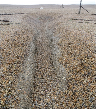
Water coming through the beach has cut a channel through the Fleet shoreline exposing the underlaying clay
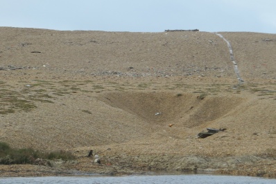
A large hole, known as a cann, has been produced in the back of the beach by water coming through and/or over the beach.
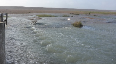
Water emerging from the rear of the beach during the February 2014 storm. Picture: A. Thomas
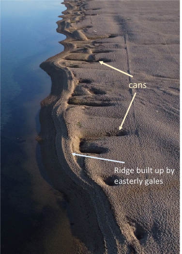
The Fleet shoreline at Ferrybridge showing cans produced by south-
At the southern end of the beach where the beach is at its widest the cans are small and numerous as can be seen in the picture to the left. Further north where the beach is narrower the cans are fewer, but much larger, as can be seen in the picture above. Good examples of the large can hollows can be seen from the end of Camp Road.
The structure of the Fleet shoreline at Ferrybridge can also be changed by easterly gales. Waves will move the pebbles pushed out into the Fleet from the cans back onto the shore to form a ridge as can be seen in the picture to the left.
| 1824 storm |