 |
Postcards from Chesil
Portland before 1920
 |
This page shows pictures from Portland at the southern end of Chesil Beach. These pictures are believed to be from the period before 1920, and may date back to 1880 or earlier. The postmark only provides a latest possible date. Some pictures were in use for up to 40 years.
The pictures are arranged in time sequence determined by the progressive development of the area.
Click on an image to see a higher resolution version of the picture.
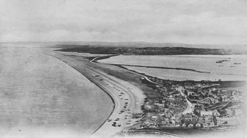
Postmarked May 1904
The Whiteheads pier can be clearly seen in the background. Note the large number of boats on the beach. There appear to be nets drying in the foreground.
(Card loaned by Veryan Walters)
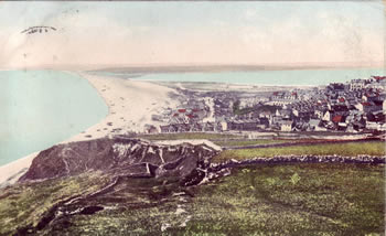
Postmarked April 1904
The area around the Mere is completely undeveloped and there are still fields in the foreground.
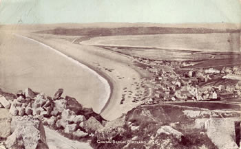
Postmarked August 1905
The buildings appear to be the same as the previous card.
The second tombolo linking Portland to Ferrybridge can be clearly seen along the northern edge of the Mere. This tombolo was formed by rock debris moving north from East Weares.
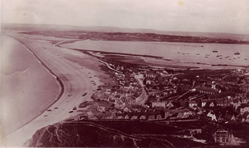
Postmarked August 1908
A new building has appeared in the fields in the bottom left of the picture and still has scaffolding on it. The pier at the Whitehead torpedo works at the bottom of Wyke Regis has appeared. There has been some work along the shoreline of the Mere.
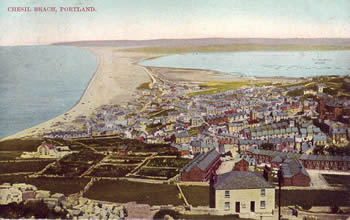
Postmarked August 1908
The building in the field has had the scaffolding removed.
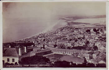
Postmarked July 1911
The work on the Mere is now more extensive than in 1908.
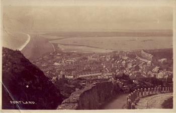
Postmarked 1920
Although postmarked 1920, this picture appears to be much earlier than that. The first two oil tanks can be seen on the right of the picture, but the tanks on the Mere have not yet appeared..